Metaphors aside, your thoughts on the Mid-Swan Project matter
Here’s the thing about national public lands: they are public. They belong to me, you, your neighbor, your cousin from Nebraska, and your old college buddies from Minnesota. Heck, even that great aunt back in New York that still sends you birthday cards shares our public lands.
The fact that the land is ours doesn’t mean we each can do whatever we want, whenever we want on the land. And it certainly doesn’t mean that the lands are always managed the way that we think they should be. But, it does mean that we — as Montanans and as Americans — have a right to care deeply about these lands, have a right to an opinion about these special places, and have a right to make that opinion heard.
Folks who care about the Swan Valley have an opportunity to do just that through the Mid Swan Landscape Restoration and Wildland Fuels Reduction Project. Or, for the sake of simplicity, the Mid-Swan Project.
The Swan: A Unique Landscape
The proposed Mid-Swan Project covers 246,000 acres of the Flathead National Forest from Swan Lake down to Condon, from the Mission Mountains to the Swan Range.
This area stands apart from Seeley Lake and the Flathead. It has its own unique culture and its own unique landscape, which each stemming, in large part, from the area’s history.
The patchwork lowlands and vast network of Forest Service roads reflect the days when Plum Creek operated throughout the valley. In the lower elevations, fragmented stands of young trees, all vulnerable to fire, are interspersed among private plots and state lands. In the higher elevations, the thick forest is homogenous and contiguous.
The valley’s remote location, accessible public lands, and abundance of wildlife and recreation have put the Swan on the map. Area residents are extremely proud and protective of the place they call home.
As the Forest Service and its partners created the draft plan for the area, they considered such questions as: Is the forest as healthy as it could be? Can this landscape become more resilient? What would include the quality of life for folks in the area?
Just like the area it covers, the answers they proposed are unique.
The Mid-Swan Project
Project managers at Flathead National Forest honed in on the areas where they could improve the health of the water and land — or where they could reduce the risk of wildfire. To identify these spots, a team of scientists and other professionals used new mapping technology and referred to the monitoring work that local nonprofits have been implementing for years. They looked to the past, to the time long before homesteaders and miners arrived, to determine what a healthy, functioning forest should look like. And they considered the future, when rising temperatures, longer hotter summers, and extended fire seasons may be the new norm. Within the 246,000 acres, they selected 70,000 acres that need work in some capacity.
The project has come a long way since its early brainstorming days in 2010. Just this October, the team at Flathead National Forest released a scoping document, one of the earliest steps in developing a project that aligns with the national environmental standards. The public has until December 24 to provide input. After that, the Forest Service will consider people’s comments, develop and release some alternative options for the Mid-Swan Project, hold another series of meetings, and accept more comments before releasing its final decision.
It’s not unusual for the Forest Service, a multiple-use agency that’s accustomed to balancing many spinning plates, to take on a project that has multiple goals. What is a bit unusual, however, is the sheer scope and size of the project. Whereas most Forest Service projects deal with 3,000 to 4,000 acres over a one to two year period, this project area covers a quarter of a million acres over the next few decades.
It’s not like the Forest Service is the first group to look at the big picture. Everyone from ranchers to wildlife enthusiasts knows you can’t judge the health of a whole forest by one aspen stand. If everyone else can see the forest through the trees, why shouldn’t the agency that manages 18 percent of our state’s land mass?
“It’s not unprecedented nationally, but it is in Region One,” explained Sandy Mack, who, until she retired at the end of November, served as the Team Lead for the Forest Service. “This project is truly a passion of mine. It’s a hard one to leave because it’s very exciting.”
Collaboration not consensus
A project this big and this complex is bound to attract lots of strong opinions about what’s working and where things are falling short. What we can and should assume, however, is that everyone ultimately wants the same things for the public lands in our backyards: healthy forests, clean water, and strong and safe communities. How we get there is where the disagreements arise.
Chip Weber, the Flathead National Forest Supervisor, understands that there will be differences, and he encourages folks to make their opinions about this epic project heard. For him, the more thoughtful voices that come together and listen to each other, the stronger this project will be.
“I am excited to bring this project forward on the Forest and look forward to hearing from our community, forest user groups, and the public at large… These public lands belong to all of you and it is important that your interests are represented as we move to restore this landscape and protect key values at risk in the Wildland Urban Interface.”
Chip Weber, Flathead National Forest Supervisor
“All of [the input] helps us make a better project, and that’s really the role of collaboration,” Weber told Prairie Populist earlier this month. “I’m a strong proponent of collaboration. I think ultimately it’s the only thing that will save our society and ecosystem.”
Big Picture
The Southwestern Crown Collaborative and the Forest Service have been chatting for years about the possibility of managing entire ecosystems, rather than the small, patchwork approach that’s often taken.
“This project is unique and intriguing in the fact that it’s looking at the landscape at a scale that let’s say a grizzly bear would roam,” said Rob Rich, the Aquatic Programs Coordinator at Swan Valley Connections. Rich is also a voting member of the Southwestern Crown Collaborative, an independent, volunteer organization that works towards creative solutions for their local public lands.
Originally, the Forest Service considered a much larger area, one that spanned 1.5 million acres over three different forests. But eventually, they scaled down to a more manageable 246,000.
“We thought this was a cool project and we encouraged [the Forest Service] to go with it,” explained Jim Burchfield, a retired forester and social scientist, who is currently the co-chair of the Southwestern Crown Collaborative. According to Burchfield, the project meets many of the Collaborative’s goals and has the potential to positively impact both people and wildlife in the area. But just because it is a good fit doesn’t mean the Collaborative doesn’t also have some questions around the planning and implementation of a project this large.
How will these high-tech mapping and modeling techniques actually play out? Will increasing the pace and scale of the decision-making process ultimately lead to better on-the-ground management? Is a project this big, with so many details, going to get locked up in litigation and never come to fruition? That’s an especially important question for a group that values getting things done, taking action, and monitoring results.
There are a lot of unknowns, but that doesn’t mean that the folks at the Southwestern Crown Collaborative are throwing in the towel.
“We’re in it for the long haul,” Burchfield explained. The group has shared its thoughts and concerns around the current proposal, and they’ll continue to work with the Forest Service as it continues to develop a strong project.
In addition to to being an efficient way to manage the land, the proposed Mid-Swan Project is economically efficient. During the early brainstorming phase of the Mid-Swan Project, the Forest Service was facing a potential 25 percent budget cut. Ultimately, they dodged those big cuts, but Weber and his team in the Flathead found ways to tighten the purse strings just in case.
There’s a lot of red-tape and legal hoops when it comes to implementing projects on public lands. That’s not necessarily a bad thing. Those processes allow us to voice our opinions about how best to protect the environmental resources we all rely on. But, those processes are often bulky, time-consuming, and expensive. Rather than go through multiple scoping documents and environmental assessments over the next few decades, the Forest Service chose to propose one large plan. In doing so, Weber and his team hoped to spend less money in the planning process, leaving more for implementation.
The Details
When folks can get past the sheer size of the project and dig down into the nitty gritty details of the proposal, there are a lot of specific, creative treatments worth looking at.
Many Swan Valley residents are happy to see such an emphasis on fuels reduction in the Wildland Urban Interface, especially considering what happened to their neighbors in the devastating Rice Ridge Fire in 2017. The high elevation forests are overgrown from years of fire suppression. The lower elevations have a tall understory that could lead to hard-to-fight crown fires. And although the Mid-Swan Project was proposed long before the Rice Ridge fire, the fire underscored the need for action.
“For this landscape to be resilient, you have to have an active fire component,” said Flathead Forest Supervisor Chip Weber. “You can’t have an active fire component if the communities are in danger.”
Other folks are excited about some of the hands-on work aimed at impacting forest health and wildlife habitat. Many of the plan’s specific suggestions build off the good work that organizations have been doing in the area for decades, whether it’s around beaver dam analogs, lynx habitat, erosion control, weeds, or whitebark pine.
Gordy Sanders is the Resource Manager at Pyramid Lumber, a family-owned mill in Seeley that employs 135 people and contracts with countless other individuals for specific projects. At this stage, the Forest Service says that 60 million board feet of timber could be harvested from the Mid-Swan Project. That alone is an exciting prospect for this local mill. Sanders and his team also welcome the opportunity to bid for Stewardship Contracts, which allow a private company to coordinate and implement the multiple prescriptions that the Forest Service has outlined for an area. In this case, if Pyramid won the bid for a Stewardship Contract within the Mid-Swan, it would hire local, independent contractors to deal with weed eradication, stream bank restoration, road maintenance, or fuel reduction in that location. That would bring a lot of potential jobs for nearby residents.
A Roadblock
To implement all of these various treatments across all these unique acres, the Forest Service proposed 60 miles of new road construction. This is one of the biggest hang-ups for folks like Keith Hammer at the Swan View Coalition (not to be confused with Swan Valley Connections), who think this area is already heavily roaded.
The Swan View Coalition is focused on protecting fish, wildlife, and water quantity. Hammer, who has also worked in small-scale, specialized logging as well as large-scale logging on the Olympic Peninsula, is concerned about the ways the Mid-Swan Project may harm the very things this groups fights to protect.
“It’s hard to argue that we need new road construction for the WUI (Wildland Urban Interface), because new road construction is not addressing problems in the WUI, nor can you consider it restoration if 60 miles of new roads are added,” said Hammer.
Much of the new road construction would take place in the steep high country, where culverts are likely to become blocked, needing constant maintenance and upkeep and causing erosion that would impact bull trout and water quality. Hammer also points out that the sheer density and number of roads in this area conflicts with the Forest Service’s old standards of road density in grizzly bear habitat. Some of the proposed logging and thinning would also require amendments to the Flathead Forest Plan around hare and lynx habitat.
The folks at Southwestern Crown Collaborative share concerns about new road construction. They also wonder how road construction will impact project funding. If the Forest Service expects to get funding from the Collaborative Forest Landscape Restoration Funding, which brings 4 million federal dollars into the region each year, the project cannot contain more new road construction.
Yellow roads signify potential new road construction, as seen in the Forest Service’s scoping document.
Photo taken by Keith Hammer in 2016 on Road #1503 indicating a blocked culvert
buried by avalanche debris.
Next Steps
People are bound to speak up on behalf of the things they care about most. The Forest Service, a public agency charged with the difficult role of managing public lands for multiple uses, will take the time to hear everyone out.
“It’s in such an early stage where people’s input on what they want to see and what their concerns are could really shape the outcome,” emphasized Rob Rich of the Southwestern Crown Collaborative.
There is still time to share your opinions about the Mid-Swan Project. The Forest Service is accepting comments electronically until December 24. It’s best to be as specific as possible about what you like or do not like. Don’t be afraid to voice your ideas about how proposed aspects of the project will impact the land, wildlife, or nearby people-and feel free to suggest alternative solutions. Afterall, these are your lands — and mine.
-Amanda Garant
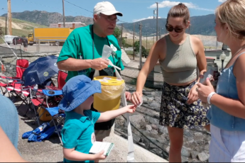
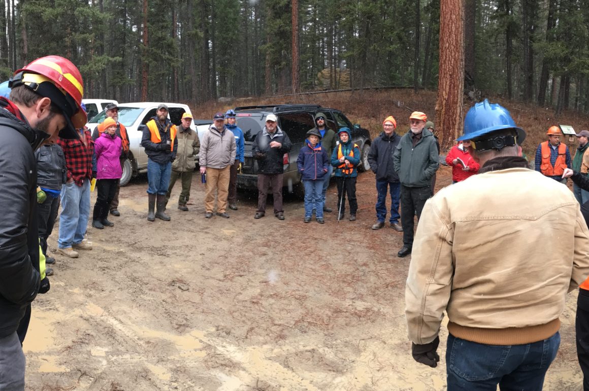
Feature photo by Rob Rich at Swan Valley Connections. It was taken at a field trip the organization held in November, 2018 into the Mid-Swan Project area.
Got something to say to Prairie Populist? Send news tips, story ideas and comments to [email protected]. If you have something to submit, or an idea for a story you’d like to write for us, check out our Submission Guidelines here.